
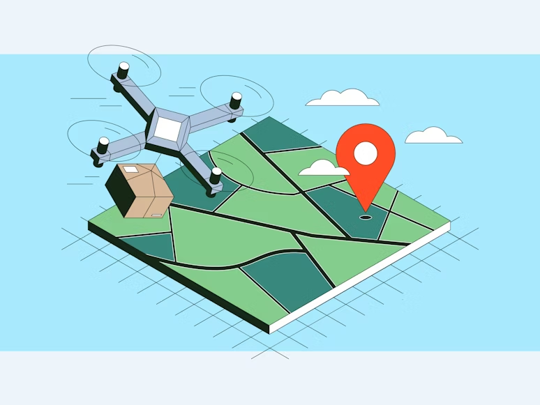
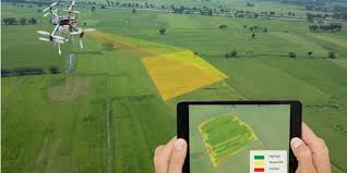
Instant,On-DemandDrone Imagery
Turnkey Aerial Intelligence
for Real-World Decisions
Get ready-to-use drone data instantly or
request fresh aerial surveys on demand
As Seen On


hours to launch workflow
Successful data captures
Customer satisfaction
Request a Free Consultation with Our Experts
We'll get back to you within one working day.
Get in touchWhy Choose Us
Why teams choose
Aero2Astro
We remove the friction between needing aerial data and actually using it. Get survey‑grade drone imagery without the operational overhead.
Start your projectInstant data access
Download ready imagery when your AOI is already in our library.
Fresh captures handled for you
We manage pilots, permissions, flights, and processing.
Consistent quality
Survey-grade outputs every time with standardized processes.
Clear project visibility
Real-time tracking and transparent progress updates.
Trusted professionals
Certified pilots and experienced data processing teams.
Built to scale
From single-site surveys to nationwide mapping projects.
Instant data access
Download ready imagery when your AOI is already in our library.
Fresh captures handled for you
We manage pilots, permissions, flights, and processing.
Consistent quality
Survey-grade outputs every time with standardized processes.
Clear project visibility
Real-time tracking and transparent progress updates.
Trusted professionals
Certified pilots and experienced data processing teams.
Built to scale
From single-site surveys to nationwide mapping projects.
The Process
How It Works
A streamlined workflow designed for speed and precision. From search to insights in record time.

Pick your area of interest
Search your AOI on the platform. If data already exists, you'll see it instantly.

Choose what you need
Select your deliverables — orthomosaics, DSMs, contours, inspections, or full analytics.

Download or request capture
If the data is in our library, grab it right away. If not, tap 'Request Update'.

We plan and execute the capture
Pilots, permissions, flight planning, compliance, and on-site execution — handled end-to-end.
Process with standards
Your data is processed through consistent workflows so outputs always align perfectly.

Track everything in real time
See exactly where your request is — scheduled, in-flight, processing, or ready.

Use immediately
Final deliverables are available instantly in your dashboard — clean and decision-ready.
Pick your area of interest
Search your AOI on the platform. If data already exists, you'll see it instantly.

Choose what you need
Select your deliverables — orthomosaics, DSMs, contours, inspections, or full analytics.

Download or request capture
If the data is in our library, grab it right away. If not, tap 'Request Update'.

We plan and execute the capture
Pilots, permissions, flight planning, compliance, and on-site execution — handled end-to-end.

Process with standards
Your data is processed through consistent workflows so outputs always align perfectly.

Track everything in real time
See exactly where your request is — scheduled, in-flight, processing, or ready.

Use immediately
Final deliverables are available instantly in your dashboard — clean and decision-ready.
Why It Works
7-step streamlined workflow
End-to-end management
Real-time tracking at every stage
Ready to get started?
All you do is pick the area and choose the deliverables. We handle everything else.
Start Your ProjectExplore Our Imagery
High-resolution aerial imagery across multiple perspectives for precise analysis and planning.
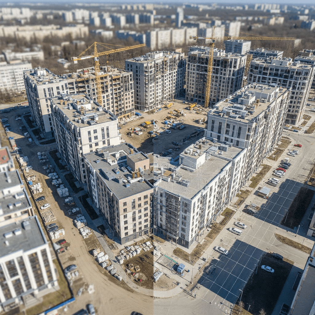
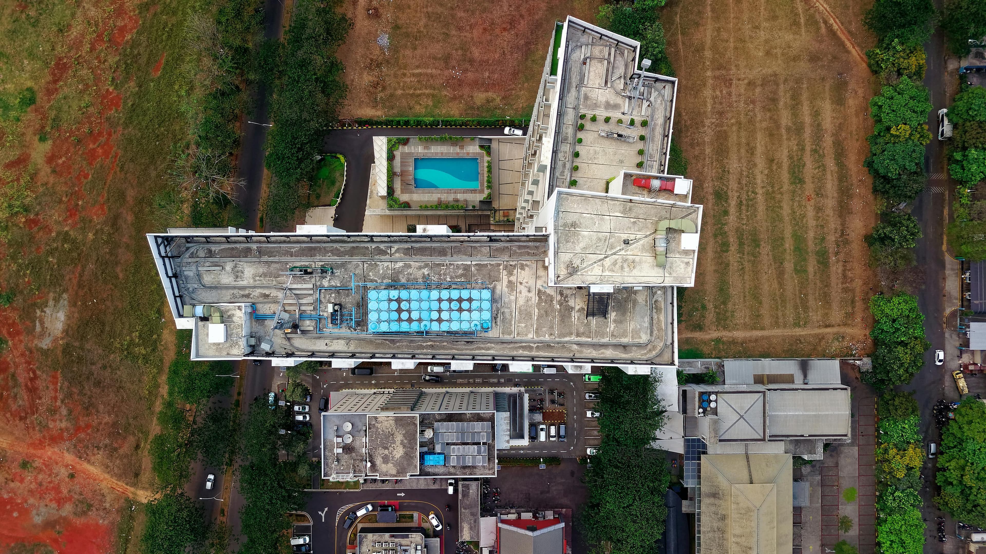
Urban Infrastructure
45° angle aerial view for detailed structural analysis
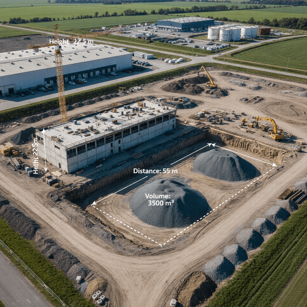
Construction Monitoring
Progress tracking with precision measurements
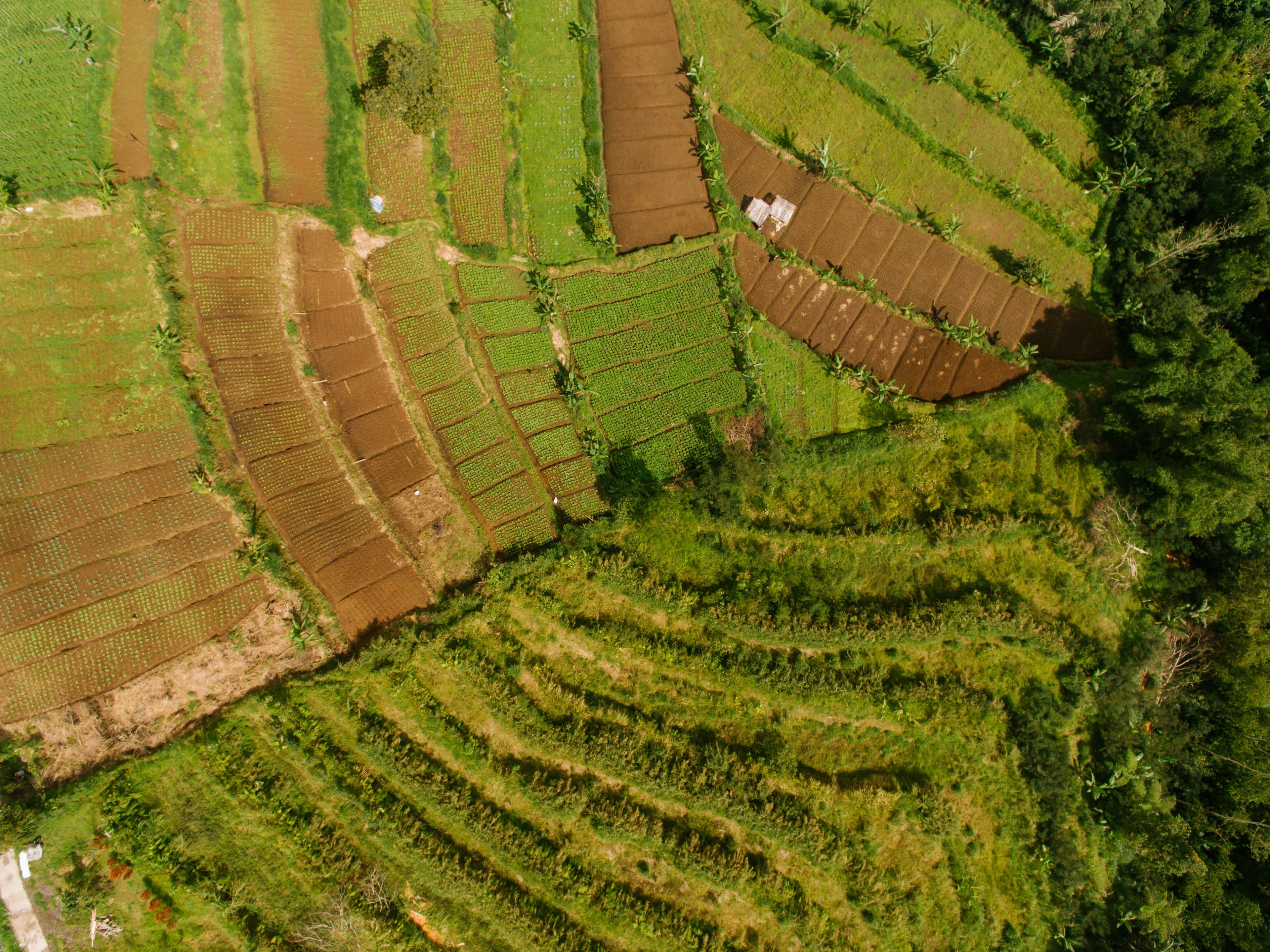
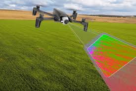
Environmental Assessment
Comprehensive terrain and vegetation analysis
Explore Our Complete Imagery Library
Access thousands of high-resolution aerial images, 3D models, and vertical maps for your projects.
Solutions
Industries Solutions
Explore highly-specialized drone intelligence systems designed to reduce downtime, increase asset visibility, and automate inspections.
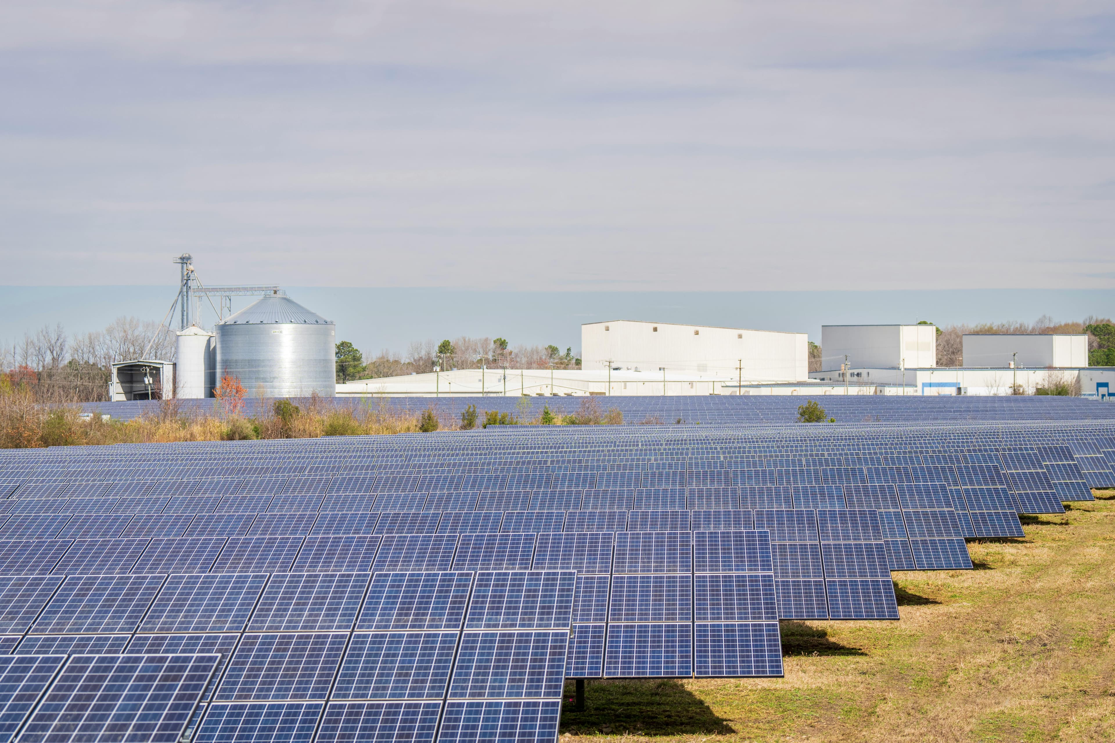
Maximize panel output
Solar Energy Platform
Detect thermal hotspots, misalignment, and power loss with high-frequency aerial surveys and AI analytics.

Protect blades & towers
Wind Turbine Platform
High-res oblique captures and AI-driven damage detection that reduce downtime and inspection costs.
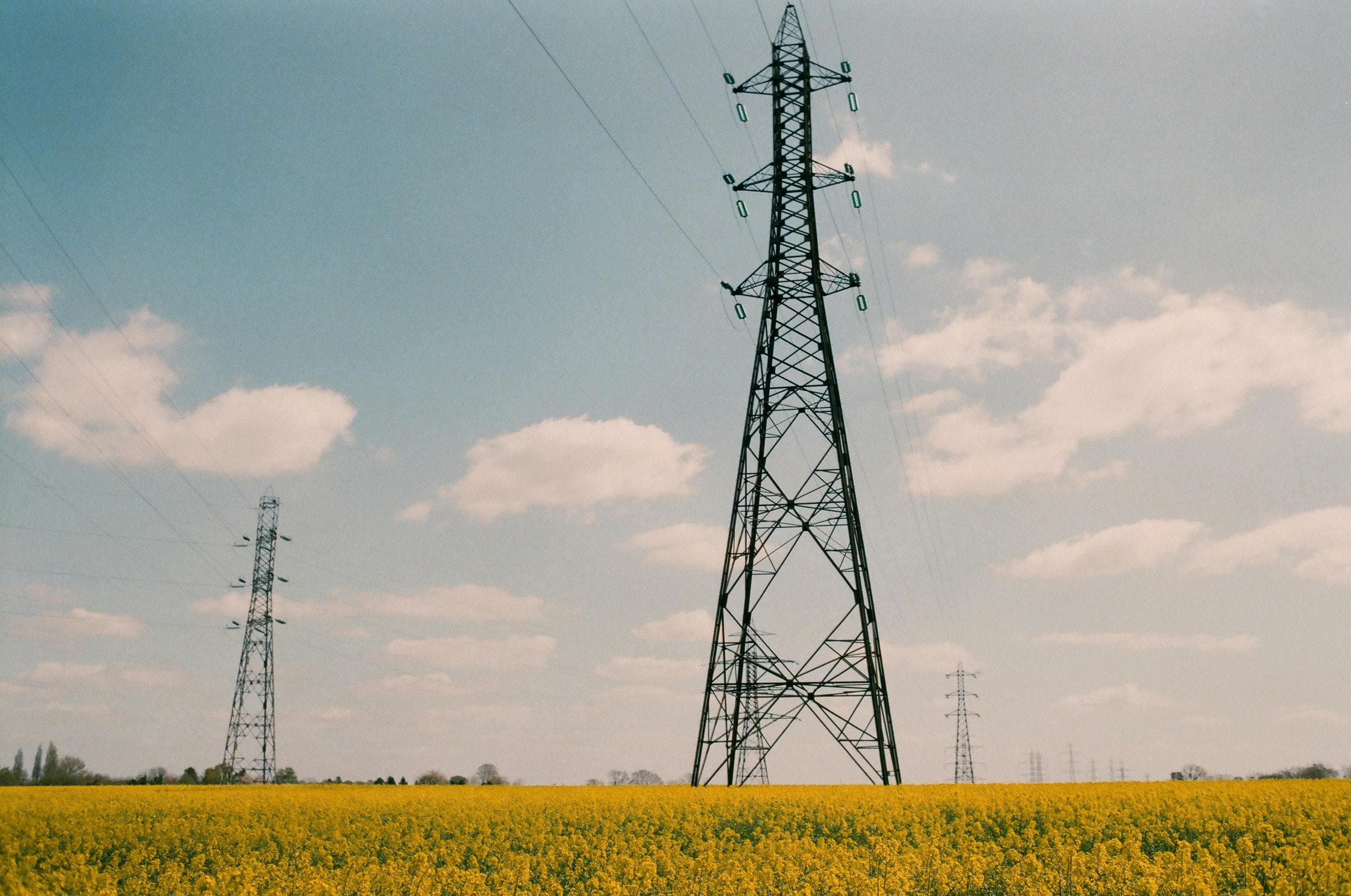
Grid monitoring, simplified
Electric Tower Platform
Automated vegetation checks, insulator diagnostics and conductor inspections with scheduled drone patrols.

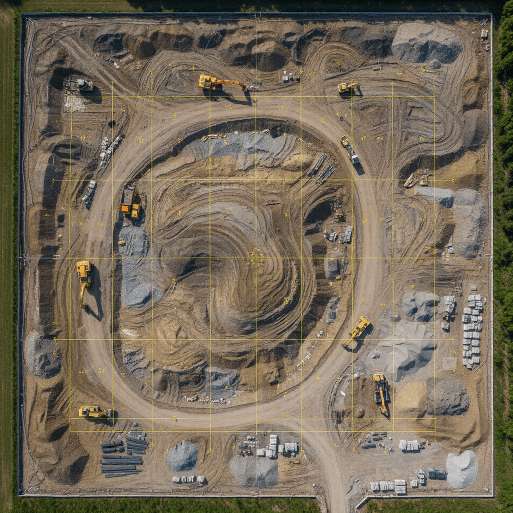
Volume & safety insights
Mining Intelligence Platform
Stockpile volumetrics, blast mapping and digital twins to speed up surveys and improve compliance.
Lifecycle monitoring
Infrastructure Insight Platform
Bridge, road and asset condition analytics for construction verification and preventive maintenance.
Maximize panel output
Solar Energy Platform
Detect thermal hotspots, misalignment, and power loss with high-frequency aerial surveys and AI analytics.
Protect blades & towers
Wind Turbine Platform
High-res oblique captures and AI-driven damage detection that reduce downtime and inspection costs.
Grid monitoring, simplified
Electric Tower Platform
Automated vegetation checks, insulator diagnostics and conductor inspections with scheduled drone patrols.
Volume & safety insights
Mining Intelligence Platform
Stockpile volumetrics, blast mapping and digital twins to speed up surveys and improve compliance.
Lifecycle monitoring
Infrastructure Insight Platform
Bridge, road and asset condition analytics for construction verification and preventive maintenance.
What Our Clients Say
Trusted by industry leaders who rely on our data for critical decisions.
"The drone imagery has revolutionized our crop monitoring. We've increased yields by 23% while reducing water usage by 15% through precise data analysis."
Tanveer
Assistant Manager
EY
"The drone imagery has revolutionized our crop monitoring. We've increased yields by 23% while reducing water usage by 15% through precise data analysis."
Tanveer
Assistant Manager
EY
"Weekly progress reports through drone imagery have saved us countless hours and improved client communication dramatically. The 3D models are incredibly accurate."
Dr Vinay
Project Manager
IIT Jammu
"Their electric tower monitoring platform has reduced our inspection time by 70%. The AI-powered damage detection is spot-on and has prevented multiple potential failures."
Pooja
Manager
Chattels
A Connected Network of Aerial Intelligence Experts
From pilots to surveyors — build mission-ready teams instantly.

Applications
Aerial Intelligence Applications
Explore real-world operational use cases powered by automated drone workflows, AI analytics, and cloud insights.
Accurate land intelligence
Surveying & Mapping
Generate precise maps, topographic models, and orthomosaics using drones with centimeter-level accuracy.
Real-time oversight
Monitoring
Track site progress, environmental change, agriculture health, and land deformation with scheduled drone missions.

Critical infrastructure visibility
Inspection
Detect cracks, corrosion, vegetation risk, and component degradation across industrial assets without downtime.
Secure, monitor, protect
Surveillance
Live aerial tracking for public safety, operations security, border monitoring, and disaster response.
Accurate land intelligence
Surveying & Mapping
Generate precise maps, topographic models, and orthomosaics using drones with centimeter-level accuracy.
Real-time oversight
Monitoring
Track site progress, environmental change, agriculture health, and land deformation with scheduled drone missions.
Critical infrastructure visibility
Inspection
Detect cracks, corrosion, vegetation risk, and component degradation across industrial assets without downtime.
Secure, monitor, protect
Surveillance
Live aerial tracking for public safety, operations security, border monitoring, and disaster response.
OUR FAQS
Questions? We're glad you asked.
General FAQ
From Our Blog
Stay updated with the latest trends, insights, and innovations in aerial intelligence and drone technology.